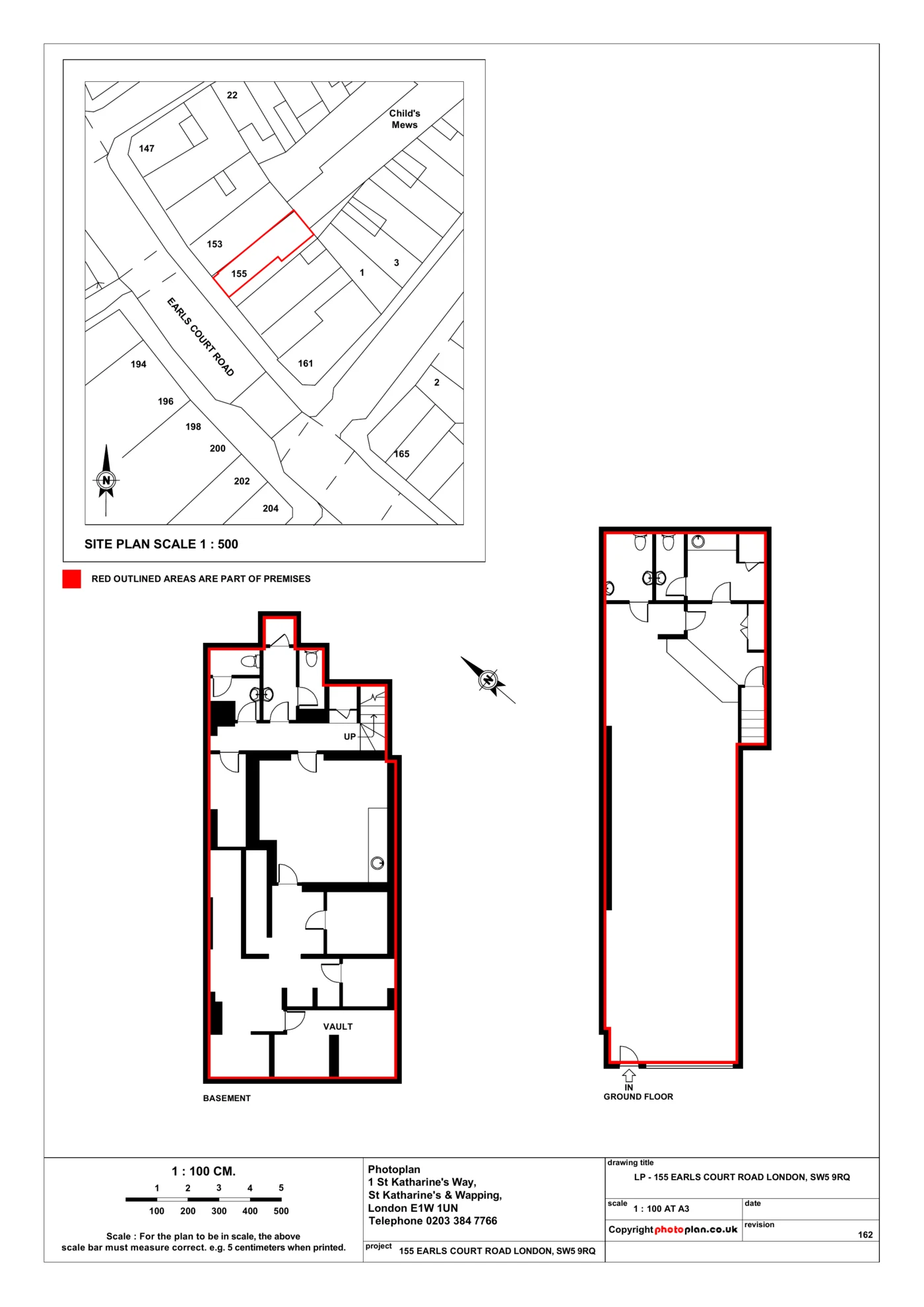
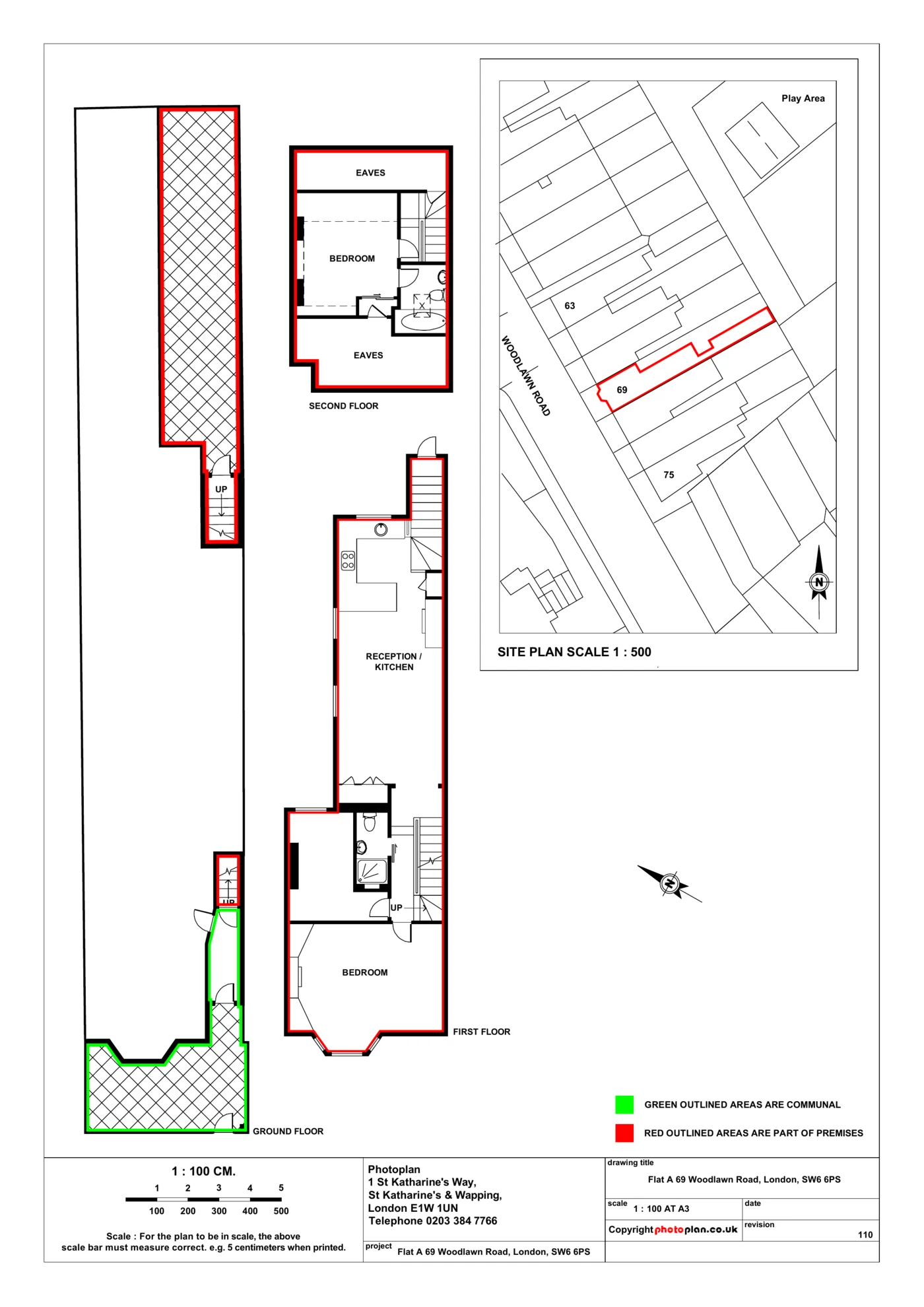
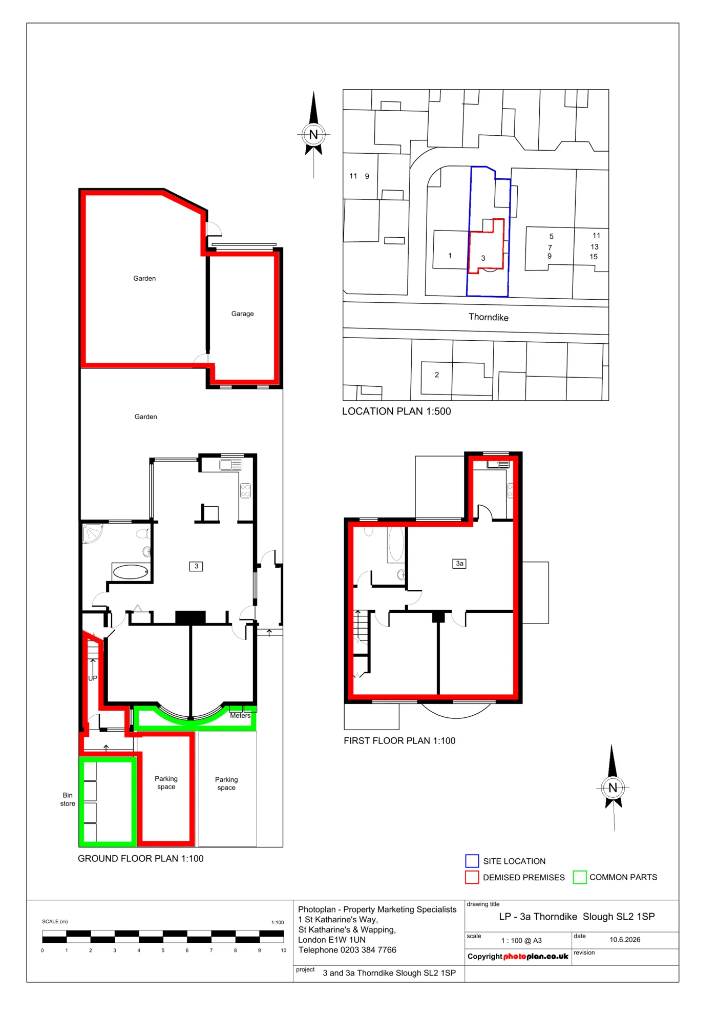
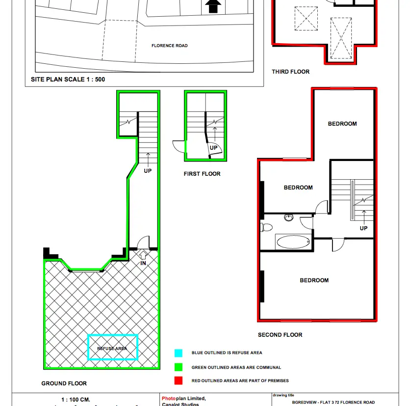
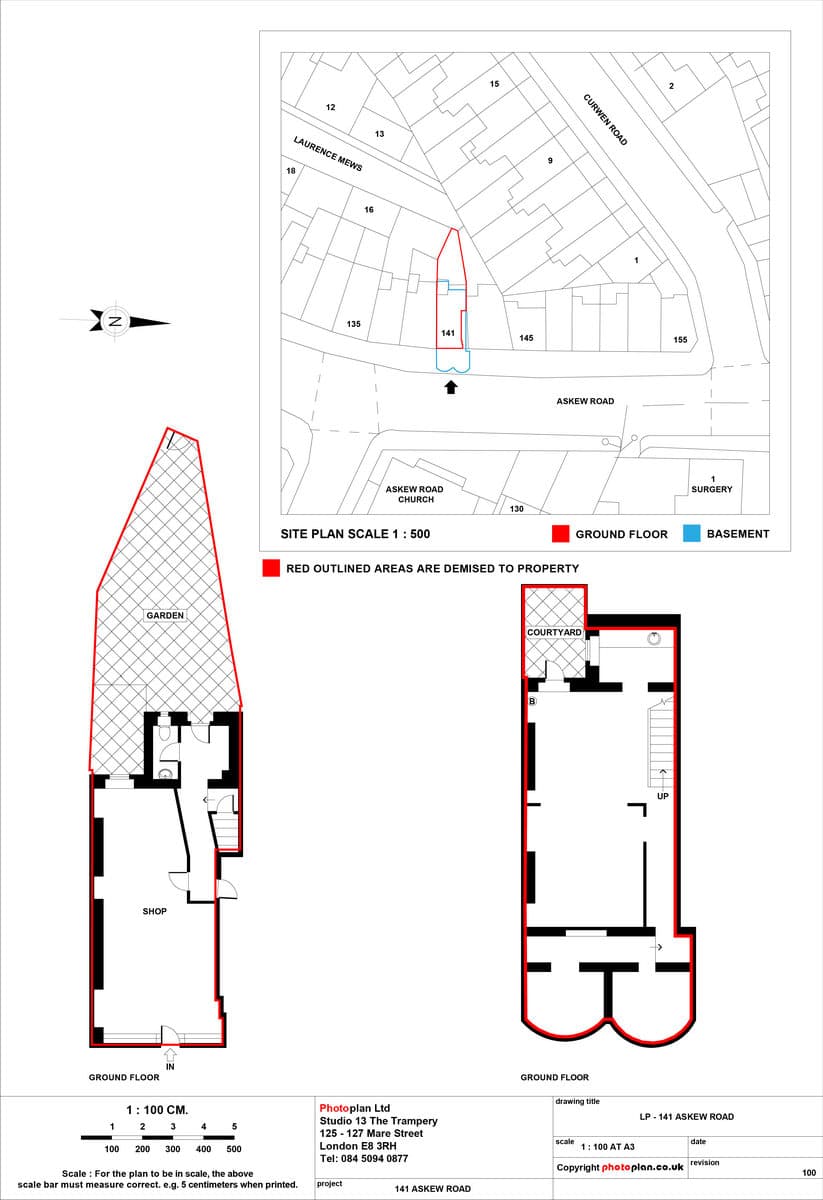
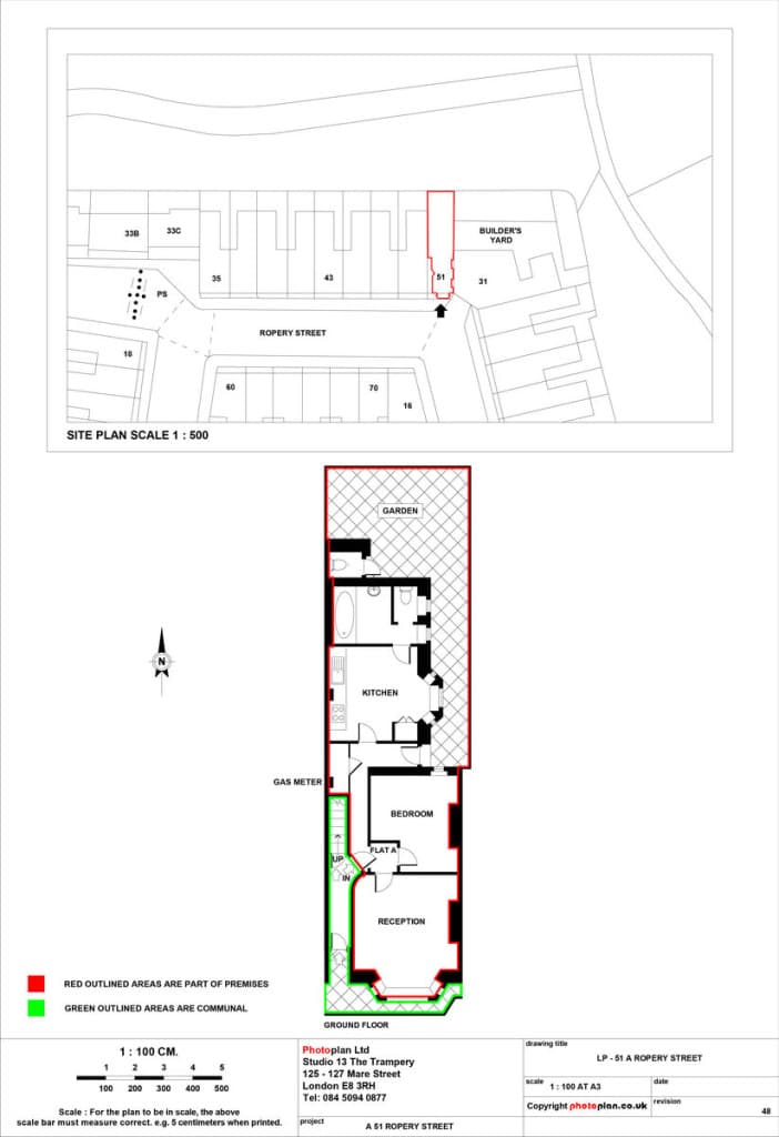
What is a Land Registry lease plan?
A Land Registry lease plan is a scaled drawing that shows the demised area of a property being leased, submitted to HM Land Registry when registering a lease of more than seven years..
- Scaled floor plan with metric scale and scale bar
- Demised area edged in red
- Shared and communal areas in green where relevant
- North point and floor levels labelled
- Ordnance Survey location plan